
Plainview ZIP Code Directory Coverage
The research confirms two postal codes associated with Plainview: 79072 and 79073. The official Texas geographic postal-code list and USPS materials support those codes as Plainview labels. The evidence does not establish a postal-boundary polygon, a split history, a complete delivery-route assignment, or a ZIP-by-ZIP count of people. Hale County has other communities with their own postal labels, so county-wide results should not be folded into Plainview.
| ZIP | Areas Covered | Post Office | Notes |
|---|---|---|---|
| 79072 | Plainview, Texas city and state lookup target | Plainview USPS service; a USPS source lists 725 Ash St. | Exact standard-delivery and PO box assignments are not located |
| 79073 | Plainview, Texas in the state geographic postal-code list | Plainview postal service grouping; exact station designation not located | Delivery geography, not a city-limit polygon |
The Texas geographic postal-code list is the state-level source for the two-code result. It is useful for confirming the label, but it cannot settle whether a particular parcel is inside the municipal boundary. That question needs an address-level comparison.
Note: No verified Plainview ZIP boundary map, ZIP realignment date, or ZIP-wide population table was located in the reviewed sources.
USPS Checks for Plainview ZIP Codes
The USPS postal lookup is the first check for a mailing label. It offers By Address, By City and State, and Cities by ZIP Code modes. Use the full street address when one is available. When several results look alike, add the apartment or suite information rather than assuming a city label supplies enough detail.
The USPS lookup interface is the postal source used for the following image.
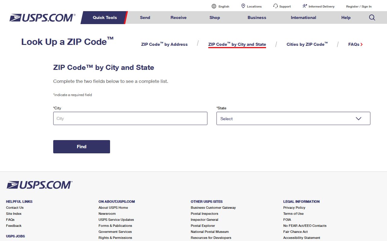
A USPS result verifies postal assignment for an address. It does not certify municipal jurisdiction, establish a parcel boundary, or identify an occupant. Recheck USPS data close to the time it is needed because delivery information can change.
Plainview ZIP Codes Do Not Draw City Limits
Plainview is a city within much larger Hale County, and a Plainview mailing label alone does not prove that the parcel lies inside city limits. The research did not locate an authoritative comparison of postal polygons, annexations, or unincorporated pockets. Treat an address with a Plainview label as a delivery-area result until a city or county geographic source confirms its jurisdiction.
Start with the postal result, then compare the Hale CAD situs address, the City of Plainview parcel or zoning view, the plat or legal description, and the taxing jurisdictions on a property card. Each source has a different role. Postal data answers delivery labeling; a parcel record identifies land; city overlays provide local geographic context.
- ZIP code
- A postal delivery code. It is useful for mail routing and lookup, but it is not a municipal-boundary statement.
- ZIP+4
- An added postal segment that further narrows delivery routing. The research did not locate a Plainview boundary use for it.
- PO box ZIP
- A code associated with post-office box delivery. Exact Plainview assignments were not located and should not be assumed.
- Carrier route
- A postal delivery grouping. It is not a verified parcel map or a household directory.
Field-by-Field Plainview ZIP Verification
Use the fields that the postal service actually publishes, not inferred local controls. By Address requires the street address, city, and state; company, apartment or suite, and ZIP are optional. City and state lookup identifies codes for a locality, while Cities by ZIP Code starts with the code. These modes verify the delivery label before a local property search begins.
| Field | Type | Required | Use or format |
|---|---|---|---|
| Company | Text | No | Optional on the USPS By Address form |
| Street Address | Text | Yes | Required for an address-based postal check |
| Apt/Suite/Other | Text | No | Add it to narrow multiple address matches |
| City | Text | Yes | Required in By Address mode |
| State | Selector or text | Yes | Required in By Address mode |
| ZIP | Text | No | Optional for By Address; the Cities by ZIP mode uses the code as input |
The tool has a Find button after the form fields. No additional Plainview-specific USPS search fields were captured. Avoid filling a form table with imagined neighborhood, boundary, or resident filters.
Hale CAD and Plainview ZIP Codes
Hale County Appraisal District Property Search is the local property starting point after postal verification. Its public search supports owner, address, property ID, legal description, subdivision, neighborhood, tax year, and advanced fields. A property card can show the situs address, owner mailing address, legal description, taxing jurisdictions, improvements, value history, and deed-history rows.
A ZIP-specific field was not visible in the basic Hale CAD form inspected for the research. Advanced search should be tested directly before a ZIP filter is claimed. Use the postal code to narrow the address you are checking, then search CAD by the supported address, owner, or identifier fields. A card is a tax and appraisal display, not certified title or proof that a person occupies the parcel.
VoteTexas Uses ZIP for a Person Match
VoteTexas My Voter Portal uses name, county, date of birth, and ZIP as individual lookup inputs. It is intended for registration status, polling-place, and election information. It is not a ZIP-wide resident browse, and the research did not capture a successful personal result or a bulk result screen.
Texas voter information also has statutory privacy limits. The public web form does not create a list of everyone in a delivery area, and protected addresses plus sensitive identifiers are restricted. If a formal voter-data request fits a lawful purpose, the Texas Secretary of State form provides a separate route with county and district choices, affidavit requirements, and its own restrictions.
Plainview’s City and County Edges
Plainview’s city grid, city zoning material, and Hale County parcel geography overlap without being the same thing. The Plainview zoning map shows streets, parcels, and zoning categories. The city’s interactive-map page directs users to its map and manual, while warning that the display is for convenience and is not warranted as complete, accurate, or current.
That limitation is useful rather than frustrating. A researcher can use the map for geographic context, copy the parcel or legal identifier where available, and compare it with CAD and the city counter. The live map controls, a boundary polygon, and a verified adjacent-parcel workflow were not captured in the source review. Do not turn a visual label into an annexation conclusion.
Find a Plainview Address by ZIP Code
ZIP information works best as the first screen in an address workflow, not as a way to make a list of local people. Move from postal information to parcel and record identifiers, keeping the source and date beside every result. The following sequence uses the documented access channels and leaves an unverified ZIP filter out of the process.
- Run the full street address through USPS By Address and save the returned postal label. Add an apartment or suite when the result needs narrowing.
- Compare that result with the city GIS or zoning source and the Hale CAD situs address. If the evidence conflicts, label it as a delivery-area question until a city or county boundary source resolves it.
- Search Hale CAD with the supported street, owner, property ID, or legal-description fields. Capture the parcel identifier, situs, mailing address, legal description, tax year, and taxing jurisdictions.
- For an older property question, take the legal description or parcel details to the Hale County Clerk for a grantor, grantee, or legal-description search. No official public county deed-index cutoff was located.
- Use VoteTexas only when you already have an individual’s name, Hale County selection, date of birth, and ZIP. It is not a postal-area directory.
Once the ZIP has narrowed an address, the Plainview street directory lookup has the fuller street and parcel workflow. Historical directory and newspaper materials should be checked separately because a printed postal label does not establish a city boundary.
Note: The recorded deed route is the County Clerk counter, a specific Texas Public Information Act (TPIA) request, or archived books and microfilm when no verified online index is available.
Plainview Postal History Needs Documents
No official Plainview ZIP split, realignment, street-renumbering, or postal-boundary history was located. That absence should stay visible. For a historical address, preserve the printed street string, compare lot and block or legal description, then use a Sanborn map, newspaper date, directory volume, or deed date as a separate check.
Older directories may print a postal city and street address without defining municipal geography. A 79072 or 79073 label is therefore one part of the record, not an answer to whether the address was in the city on the relevant date.
Plainview ZIP Statistics Are a Gap
No local per-ZIP population or voter-registration table was located. Census QuickFacts supplies city-level context, while a statewide voter-file request does not automatically produce a ZIP report. Do not create totals by counting search pages or combine PO boxes, routes, and municipal addresses into a made-up population figure.
If a dated count is needed for a civic or research question, request a table from the appropriate custodian and record its date, coverage, suppression rules, and definition of the area. That approach is more reliable than treating a postal label as a stable neighborhood boundary.